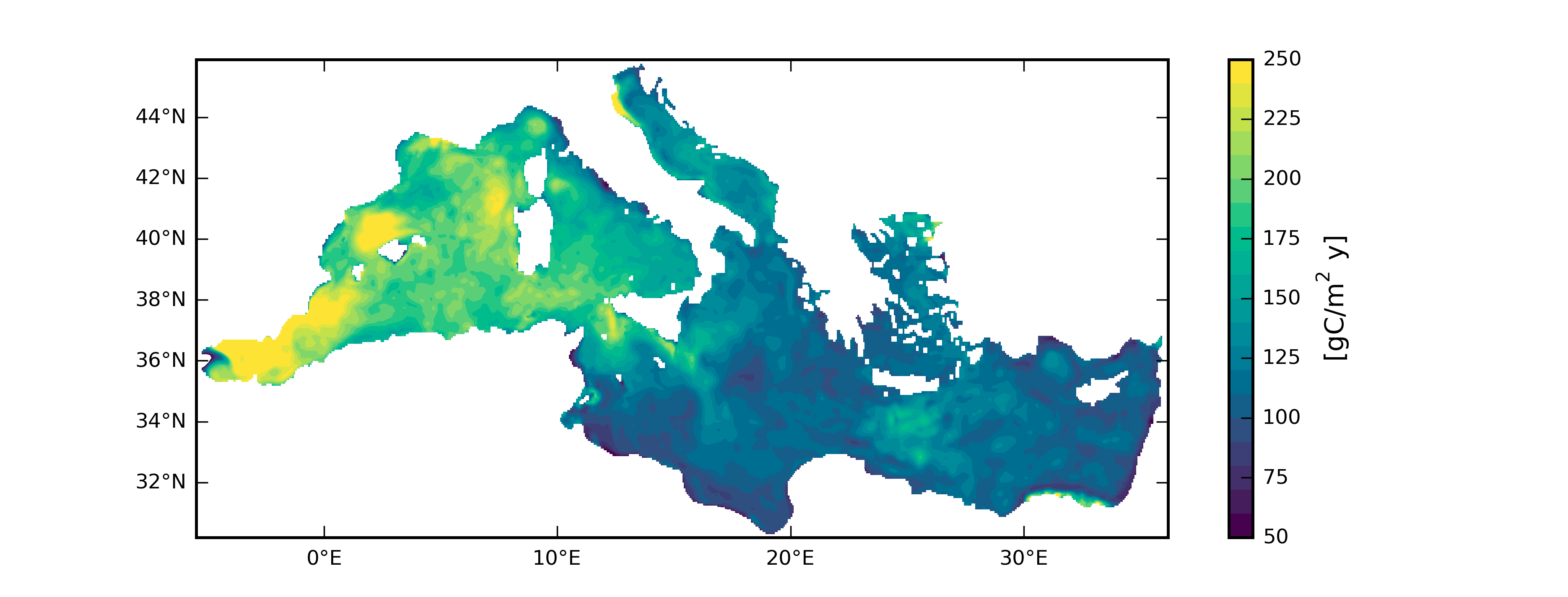
Map of the vertically integrated mean annual primary production in the Mediterranean Sea shelf and open seas for 2013 as in Teruzzi et al. (2018; https://doi.org/10.1016/j.ocemod.2018.09.007).
The spatiotemporal descriptions of chlorophyll and other biogeochemical variables in the Mediterranean Sea, including coastal areas, has been improved integrating satellite ocean-colour observations with a coupled physical biogeochemical model by means of data assimilation. The high spatial and temporal variability of biogeochemical features, induced by local dynamics and terrestrial and atmospheric inputs in shelf seas, are challenging issues for the implementation of data assimilation in these areas.
The results obtained using full-basin data assimilation indicate that the relevant spatial variability of primary production are well reproduced, and highlight the prominent role that shelf-seas play in primary production in some specific areas of the Mediterranean Sea, which is an aspect difficult to capture using only in situ measurements.
In the map of primary production, local patches of high production highlights the heterogeneous presence of high-productivity areas close to the coasts (i.e., the western part of the Italian Adriatic coast, Dardanelles and Nile mouth regions). In the Adriatic Sea, the mean values of primary production are higher in shelf than in open sea, while in the western Mediterranean the mean primary production is higher in the open sea, highlighting that shelf-seas phenomena contribute significantly to primary production in the Adriatic Sea, which is a semi-enclosed basin strongly affected by coastal processes, and less in western Mediterranean.